Pacific Crest Trail on Glacier Peak: Part 2
“Four days, 55 miles, 14,000 feet gained, and 13,000 feet lost”

The third day out on a four day hike, my friend Brad and I woke up to a misty morning outside our tents at Pumice Creek. Just as we got packed up and back on the Pacific Crest Trail (PCT), the rain started to fall. This day was going to be full of views that I had never before seen and was beginning to realize that, with the thick fog and rain, I would still not know the true beauty here.
The rain continued up Fire Creek Pass and down to the creek itself. Another climb brought us high on a ridge above the yet unseen Mica Lake. It was very windy and cold at that point and views seemed like they would have been unobscured from there. I was not even able to take a photo of the old Cascade Crest sign that somewhat marked our direction due to a wet phone and shivering hands.
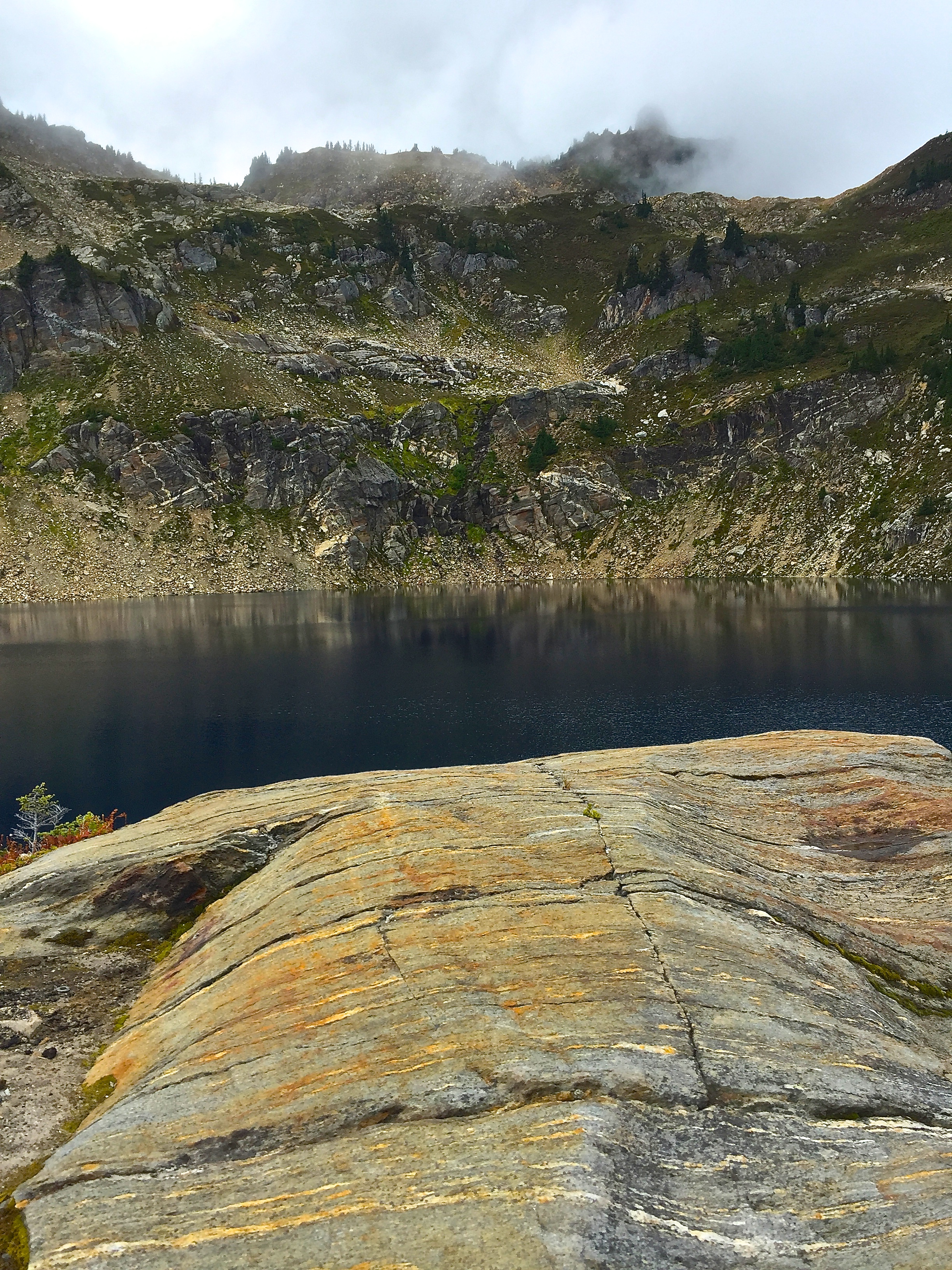
Climbing downward, the rain stopped and the clouds started to lift! This was perfect timing for the display of Mica Lake. It is the only true lake along this section of the PCT and it was nearly right in the middle of our trip. The sun popped out of the clouds long enough to heat me up and somewhat dry us out. What a great destination Mica Lake is.
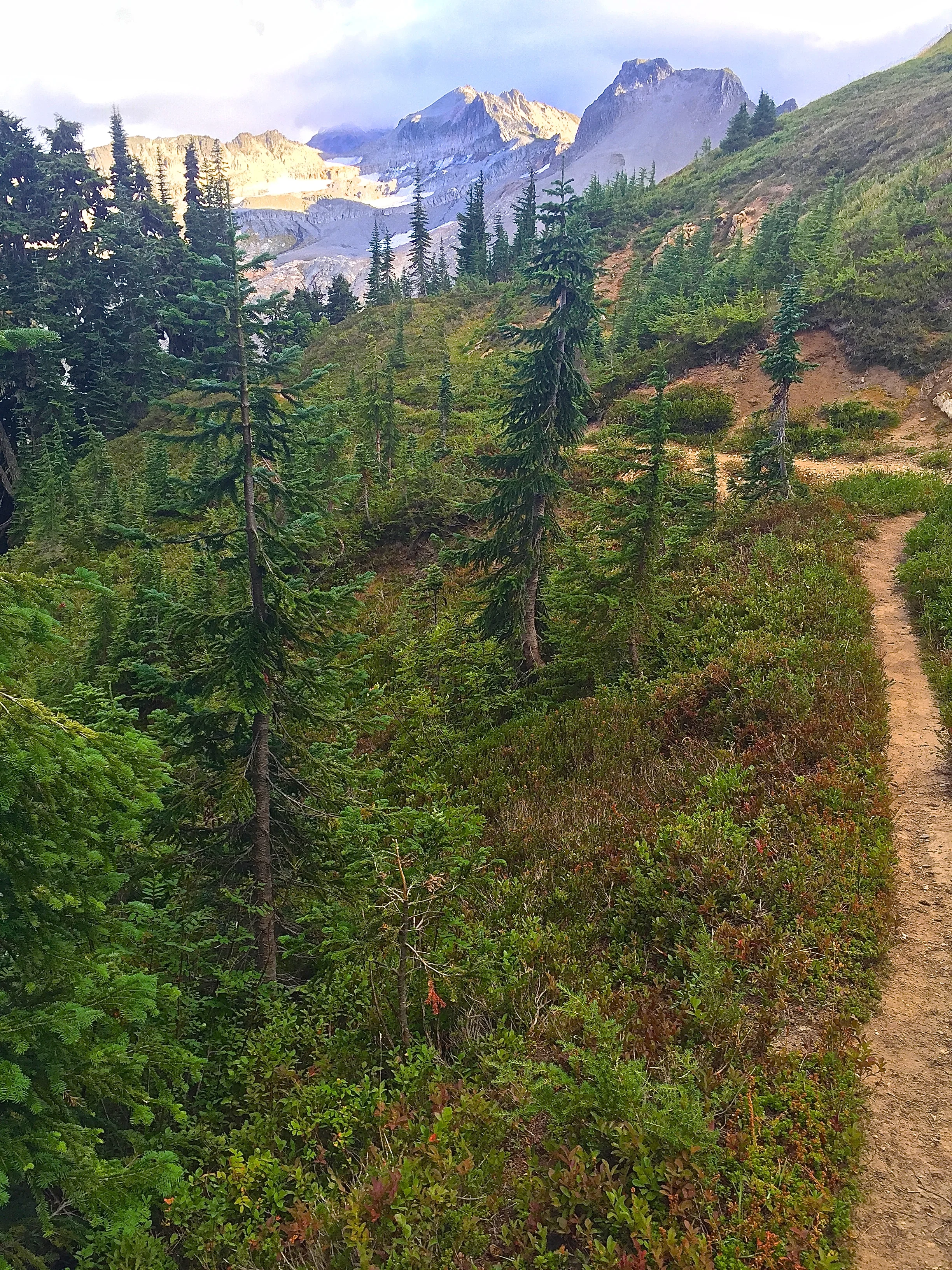
Next the PCT dropped us way down to cross Milk Creek on a heavily reinforced wooden bridge. Crossing over to the north side of the creek, we then climbed up the other side. The top of this ridge, and the trail up, gave us great views of Glacier Peak. We had our minds set on the campsite that is right at the top of the climb.

A dried up creek there made us continue on... no water at the next creek either. As we neared a roaring basin, we came across a fellow hiker, who had set up camp alongside the trail. He was able to tell us all about the upcoming water and campsite options. Very tired and weighing our options, we set up camp next to him.
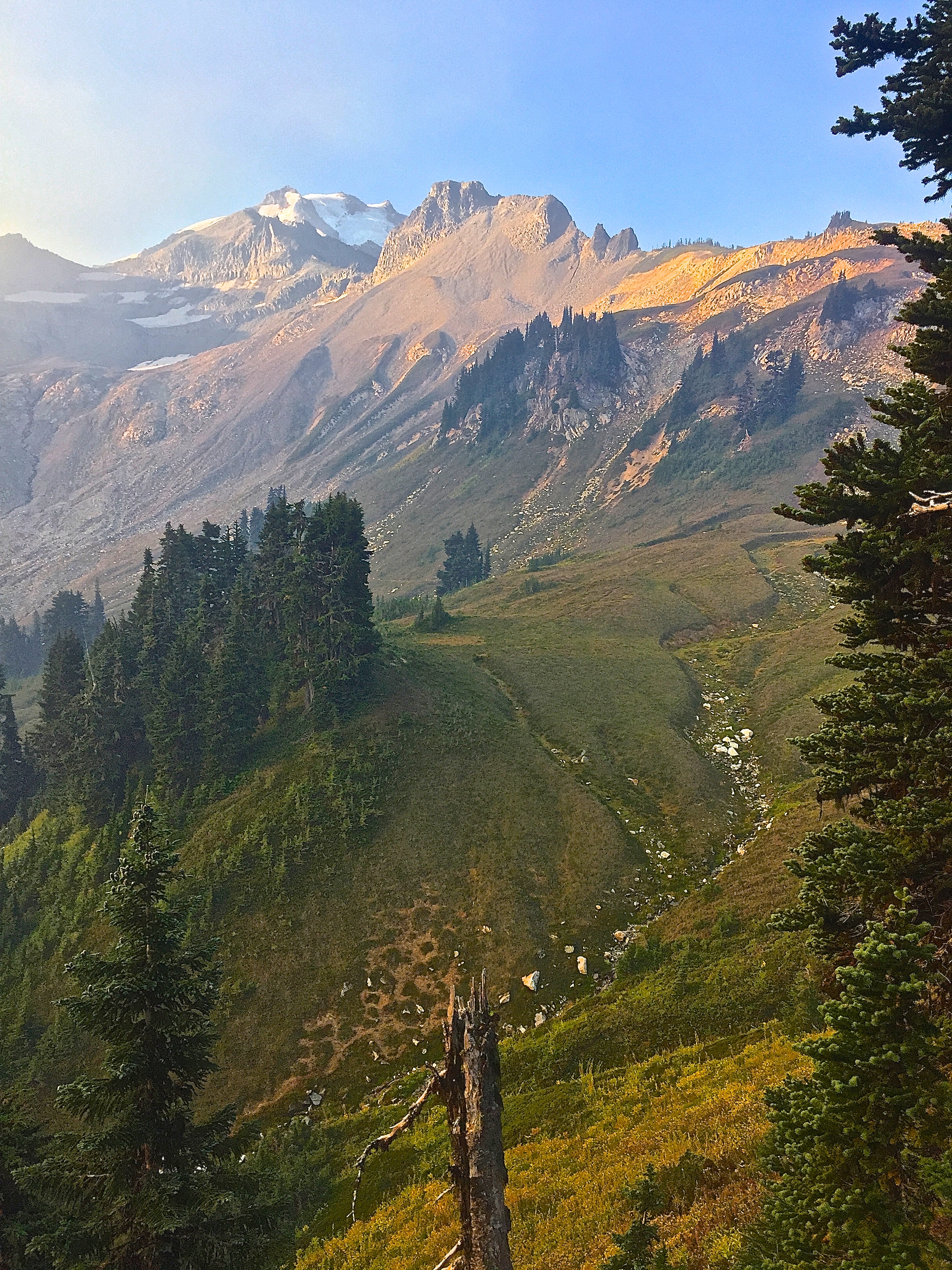
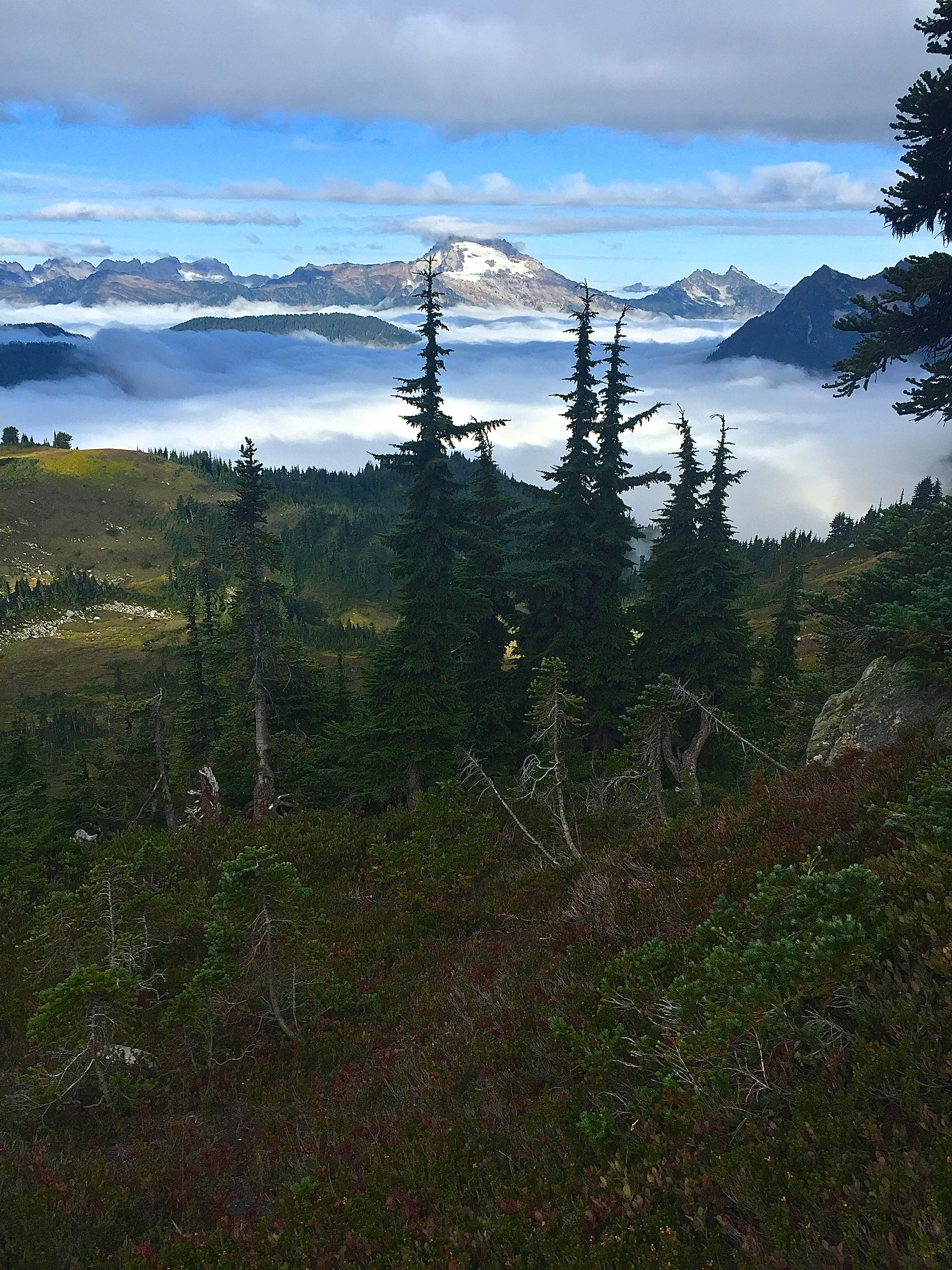
The clouds had completely dissipated and the views here were perfect. The scariest thing happened the next morning as the three of us awoke. We knew about the trail closures due to fires just north of our location, but, having not seen any smoke on our whole trip, we were not expecting it now. The ridge we could see that marked our final ascent, and decent on the other side, had smoke pluming over it.
By the time we filled our water up at the East Fork Milk Creek, smoke had taken over the whole hillside and visibility was getting worse. Scared that a new fire may be blocking our only exit, we pushed on.
As we crested the ridge and started to drop off the other side towards Dolly Creek, we ran into a Father and his two teenage kids. They informed us that there was not another fire, but the statewide fires had worsened while we were out of society. News doesn't travel very fast with no phone service and only seeing a few other people a day.
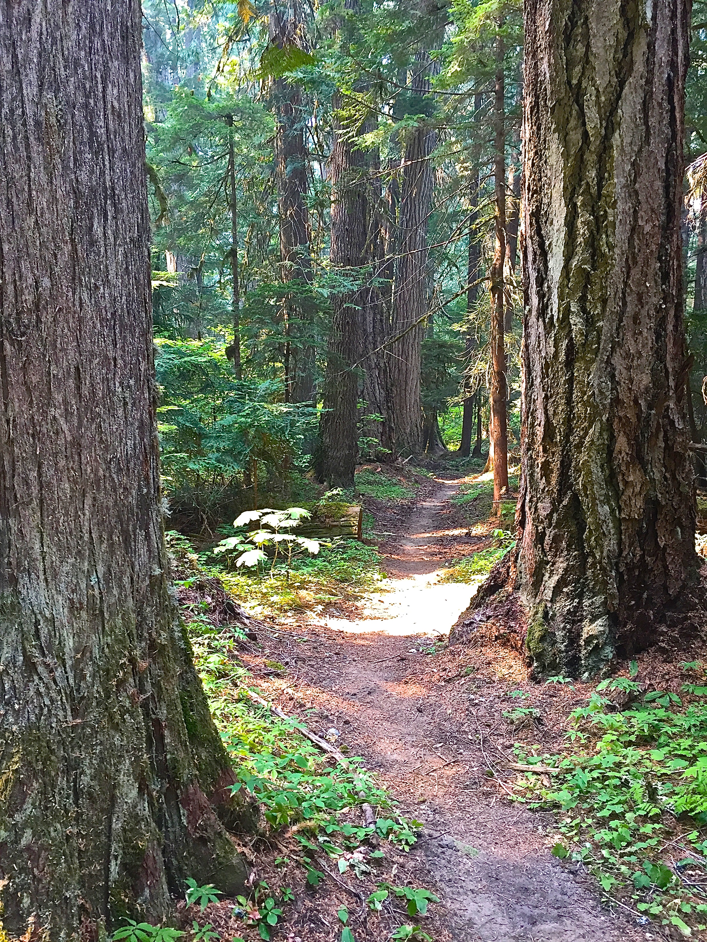
Many switchbacks brought us down past Dolly Creek Camp and the old trail junction that used to lead across the Suiattle River before floods washed out that bridge. The PCT now has a two to three mile detour down river to a new bridge. Along this part of the trail is a small grove of huge Red Cedars that added a very cool and new perspective to the area.

All that was left was following the Suiattle Trail to my car that was parked at the trailhead. This path is well maintained and a very beautiful walk. Though, when you are trying to use it as an exit off of a long hike, it seems very repetative and very long. We had a blast on this remote section of the PCT in northern part of our Washington Cascades.
To read part 1 of this hike
CLICK HERE
By Rudy Giecek